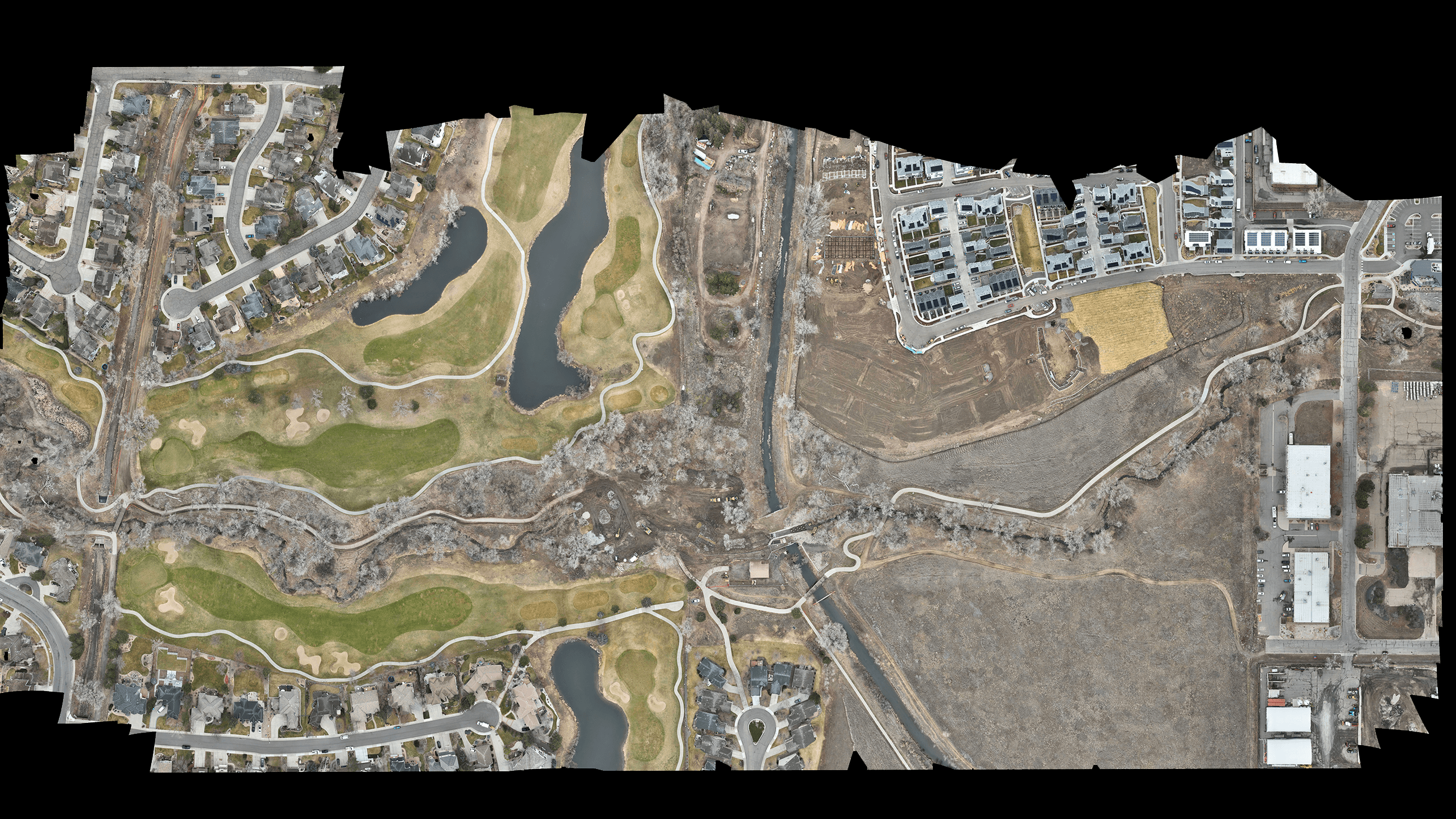
ABOUT THIS PROJECT
The City of Arvada and Mile High Flood District (MHFD) are leading the Ralston Creek at Croke Canal Stream Stabilization Project to improve stream health, enhance flood resilience, and restore the corridor’s stability. Naranjo Civil Constructors (NCC) has been selected as the general contractor, with Olsson as the design engineers and Valerian as the landscape architects.
This section of Ralston Creek, located near the Westwoods subdivision just west of the Croke Canal crossing, was heavily impacted by the September 2013 floods, resulting in channel instability, property damage, and embankment breaches along the Croke Canal. This project will address those challenges while also improving pedestrian access and ecological conditions in the area.
Key Project Features
• Channel stabilization and flood resilience by increasing the flow capacity of Ralston Creek at the Croke Canal crossing to reduce future flood risks
• Replacement of the existing pedestrian bridge with a larger, flood-resilient structure to prevent constrictions in the floodplain
• Improvements to the Ralston Creek Trail for better safety, connectivity, and alignment for pedestrians and cyclists
• Vegetation and habitat restoration through the removal of overgrown and hazardous trees while strategically planting new vegetation to support wildlife and stream health
• Natural stream design using sustainable, aesthetic, and resilient stabilization techniques to enhance the ecological function of the creek
This project is a collaboration between MHFD, the City of Arvada, Olsson, Valerian, and NCC to restore Ralston Creek while balancing flood protection, recreation, and environmental stewardship.
CLIENT
Mile High Flood District
LOCATION
Arvada, CO


WATCH NOW
PROJECT SHOWCASE VIDEO
From a bird’s-eye perspective, you can see the incredible work being carried out by Naranjo Civil Constructors on-site. With a commitment to environmental restoration and construction excellence, our team is transforming the landscape while ensuring the highest standards of quality and sustainability.
VISUALIZE IT
INTERACTIVE CAD OVERLAY
Explore the engineered design seamlessly overlaid onto the most up-to-date, high-resolution drone survey of the project site. This powerful visualization highlights both the precision of our engineering and the accuracy of our aerial data, providing a clear picture of how the design integrates with existing site conditions.
View CAD Overlay
View Now
")
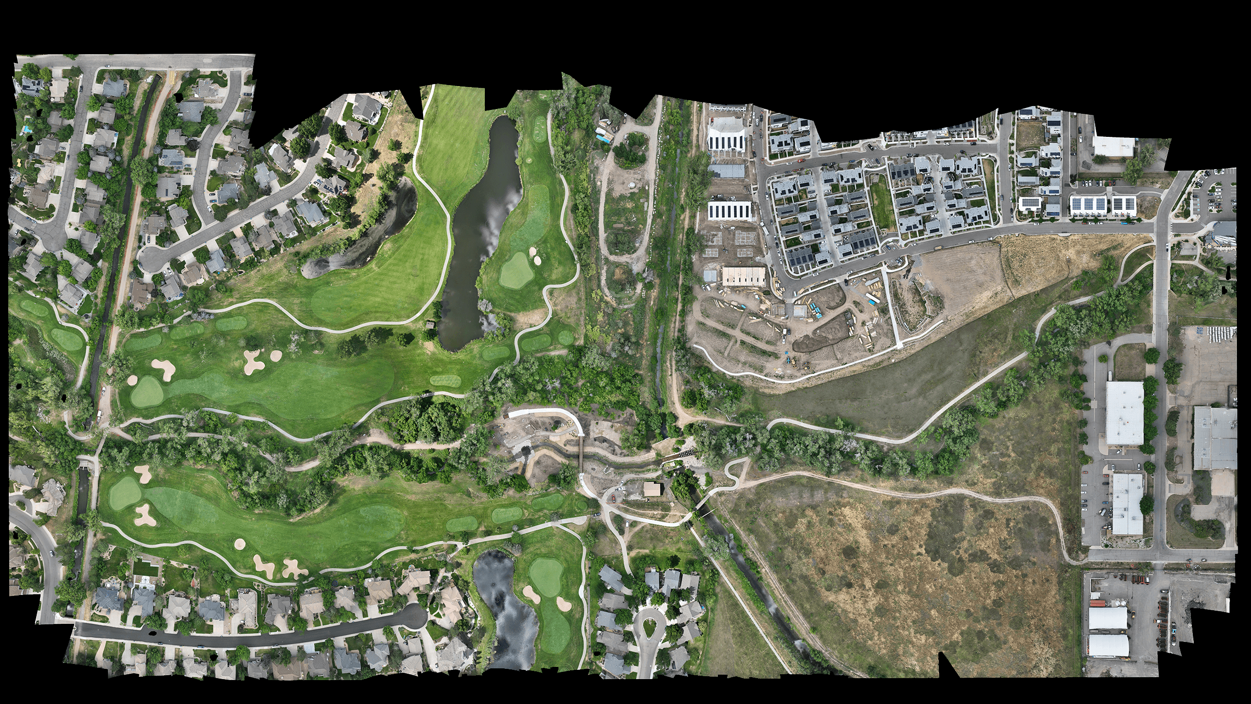
PROJECT EVOLUTION
Experience the progress first-hand with our interactive image comparison slider. Seamlessly switch between before-and-after views to see the impactful changes made on-site, highlighting the transformation and precision of our work.”