ABOUT THIS PROJECT
The Lee Gulch at Carbone Park Improvements Project is a collaborative effort led by the Mile High Flood District (MHFD) in partnership with the City of Littleton and the South Suburban Parks and Recreation District (SSPRD). Naranjo Civil Constructors serves as the prime contractor, with Olsson as the design engineer, Stream as the landscape architect, ERO Resources providing environmental and permitting support, and Western States Reclamation overseeing revegetation efforts throughout the corridor. This project focuses on stabilizing the Lee Gulch channel and constructing two new pedestrian crossings. These improvements will address active bank erosion, enhance stormwater performance, and support long-term resilience in the Carbone Park area. According to the pre-construction meeting minutes, the project includes channel stabilization, pedestrian access upgrades, vegetation restoration, and coordination around bridge repairs, tree removal, log riffle salvage, and box-culvert modifications. Beyond its technical goals, the Lee Gulch project provides meaningful community benefits. It strengthens aging drainage infrastructure, expands safe trail connectivity, improves park user access, and restores habitat with native plantings. Through close coordination among MHFD, Littleton, SSPRD, and the project design and construction team, the work will be executed with a focus on safety, environmental responsibility, and minimal disruption to surrounding residents and park users.
CLIENT
Mile High Flood District
LOCATION
Littleton, Colorado


WATCH NOW
PROJECT SHOWCASE VIDEO
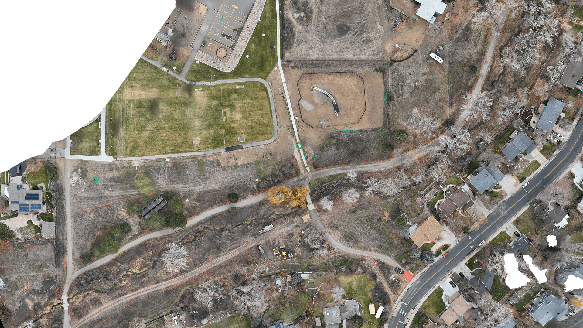
From a bird’s-eye perspective, you can see the incredible work being carried out by Naranjo Civil Constructors on-site. With a commitment to environmental restoration and construction excellence, our team is transforming the landscape while ensuring the highest standards of quality and sustainability.
VISUALIZE IT
INTERACTIVE CAD OVERLAY
Explore the engineered design seamlessly overlaid onto the most up-to-date, high-resolution drone survey of the project site. This powerful visualization highlights both the precision of our engineering and the accuracy of our aerial data, providing a clear picture of how the design integrates with existing site conditions.
View CAD Overlay
View Now

PROJECT EVOLUTION
Experience the progress first-hand with our interactive image comparison slider. Seamlessly switch between before-and-after views to see the impactful changes made on-site, highlighting the transformation and precision of our work.”