ABOUT THIS PROJECT
The Niver Creek Open Space Improvements project was initiated to mitigate recently identified local flood risks.
This project is specific to a nearly half mile stretch of channel improvement work beginning in Fall 22’ and being completed in Spring 23’. Along with our partners, we will be building a channel stabilization and realignment project from approximately Thornton Parkway east to where Niver Tributary M meets Niver Creek on the east side of Niver Open Space. The purpose of the project is to protect underground utility pipes from erosion, reduce the slope of steep banks to create a more natural creek bed, and to promote access to the water.
Landscape architects are currently designing improvements to Niver Open Space, including boardwalks to provide access to the creek, scenic pedestrian overlooks and resting areas, trailhead parking and other passive recreation amenities. These features are still in design, but will be coming in 2023.
The project is being funded by Mile High Flood District and the City of Thornton. Otak Inc. is the design engineer, Stream Landscape Architecture provided landscape architecture services, Naranjo is the Civil Constructor, and Habitat Management will be providing the landscape restoration.
We look forward to helping reduce local flood risks, to protect existing utility pipes from erosion, and to better serve the local community with improved open space access.
CLIENT
Mile High Flood District
LOCATION
Thornton, CO


WATCH NOW
PROJECT SHOWCASE VIDEO
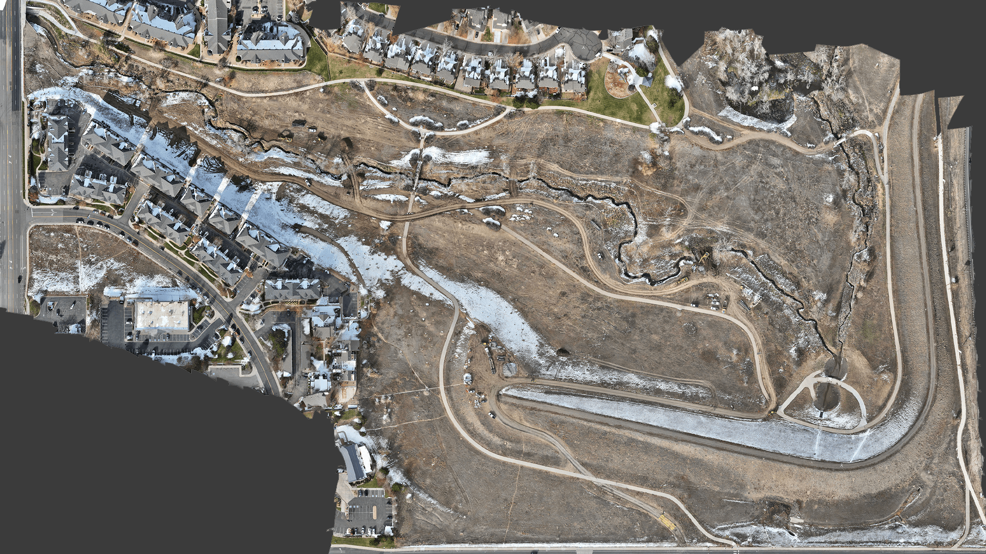
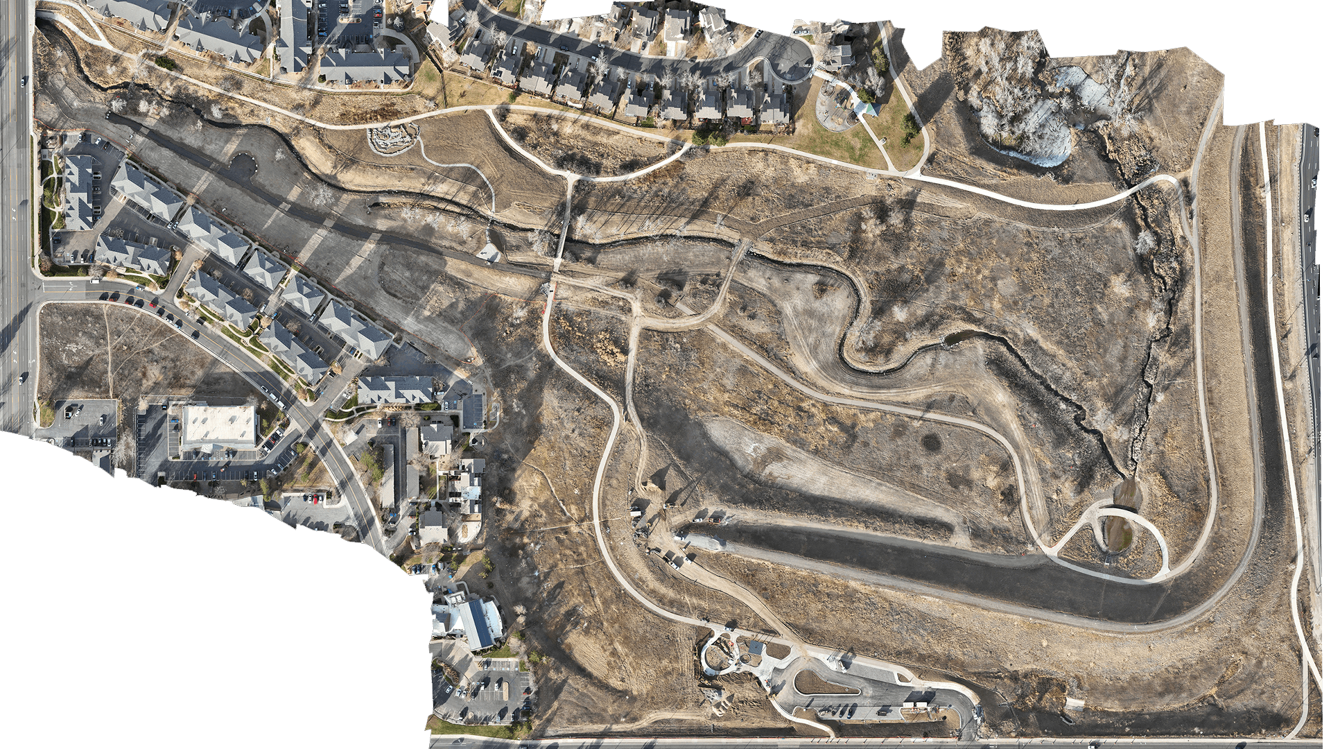
From a bird’s-eye perspective, you can see the incredible work being carried out by Naranjo Civil Constructors on-site. With a commitment to environmental restoration and construction excellence, our team is transforming the landscape while ensuring the highest standards of quality and sustainability.
VISUALIZE IT
INTERACTIVE CAD OVERLAY
Explore the engineered design seamlessly overlaid onto the most up-to-date, high-resolution drone survey of the project site. This powerful visualization highlights both the precision of our engineering and the accuracy of our aerial data, providing a clear picture of how the design integrates with existing site conditions.
View CAD Overlay
View Now
")
PROJECT EVOLUTION
Experience the progress first-hand with our interactive image comparison slider. Seamlessly switch between before-and-after views to see the impactful changes made on-site, highlighting the transformation and precision of our work.”